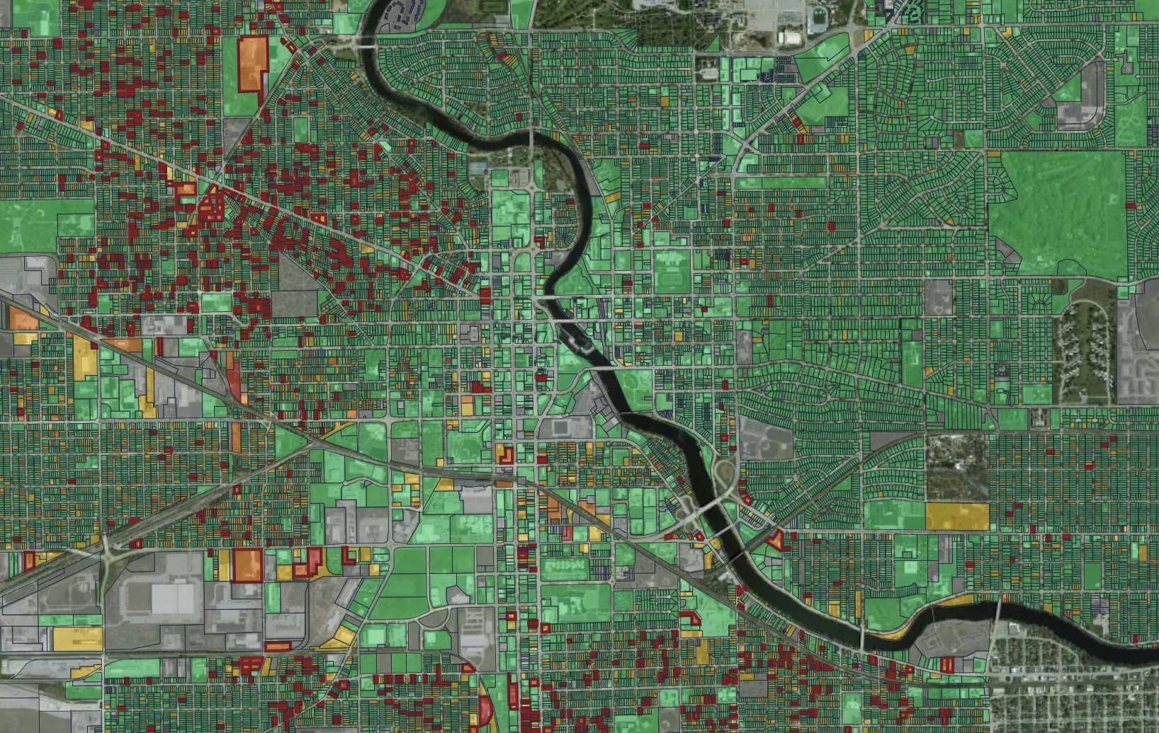
We drive your city, capturing photos from the public right-of-way. Our AI analyzes properties and roadways, providing actionable insights that help your departments shift from reacting to problems to getting ahead of them.

Streets and parcels, once a quarter or every week
Each vehicle is equipped with three high-resolution cameras: one facing forward and one facing to each side. This setup captures comprehensive street-level imagery in a single drive: the road ahead, and both sides of the public right-of-way. One dataset powers every Placemetry product, giving all city departments the visual intelligence they need.
Forward-facing cameras optimized for roadways and infrastructure. In a single pass, we deliver per-segment pavement condition, an asset inventory, and safety screening, fully aligned with the standards your DOT and Public Works teams already use.
Roadway condition assessmentHigh-resolution side cameras capture a wide view of the public right-of-way in one pass, including properties, yards, sidewalks, trees, and vegetation. One dataset powers Code Enforcement, Economic Development, Forestry & Parks, and more.
Property condition assessmentThe 35+ feature list is a floor, not a ceiling. Tell us what your department needs evaluated and we’ll add it to the model.
Every product delivers the same data and AI. The difference is in how often the data shows up and who’s doing the driving.
Best for roadway and housing inventory. A single citywide survey. The fastest way to see what’s on the street. We make it easy: no subscription required.
Best for tracking program impact. Quarterly or bi-annual citywide sweeps. Our teams drive every street and our AI scores properties. You get the insights; we handle the mileage.
Best for supporting code compliance. Our cameras on city vehicles you already operate. Garbage trucks and street sweepers capture passive citywide coverage; code & parking enforcement vehicles cover priority areas on demand.
All imagery is captured from the public right-of-way. Faces and license plates are blurred. Your city owns the data.
Access our platform via direct API integrations, standard spreadsheet downloads, or our secure web app to power every city department. Deploy via clean REST API Endpoints and Webhooks with zero local installation.


Get your free pilot data in three simple steps: